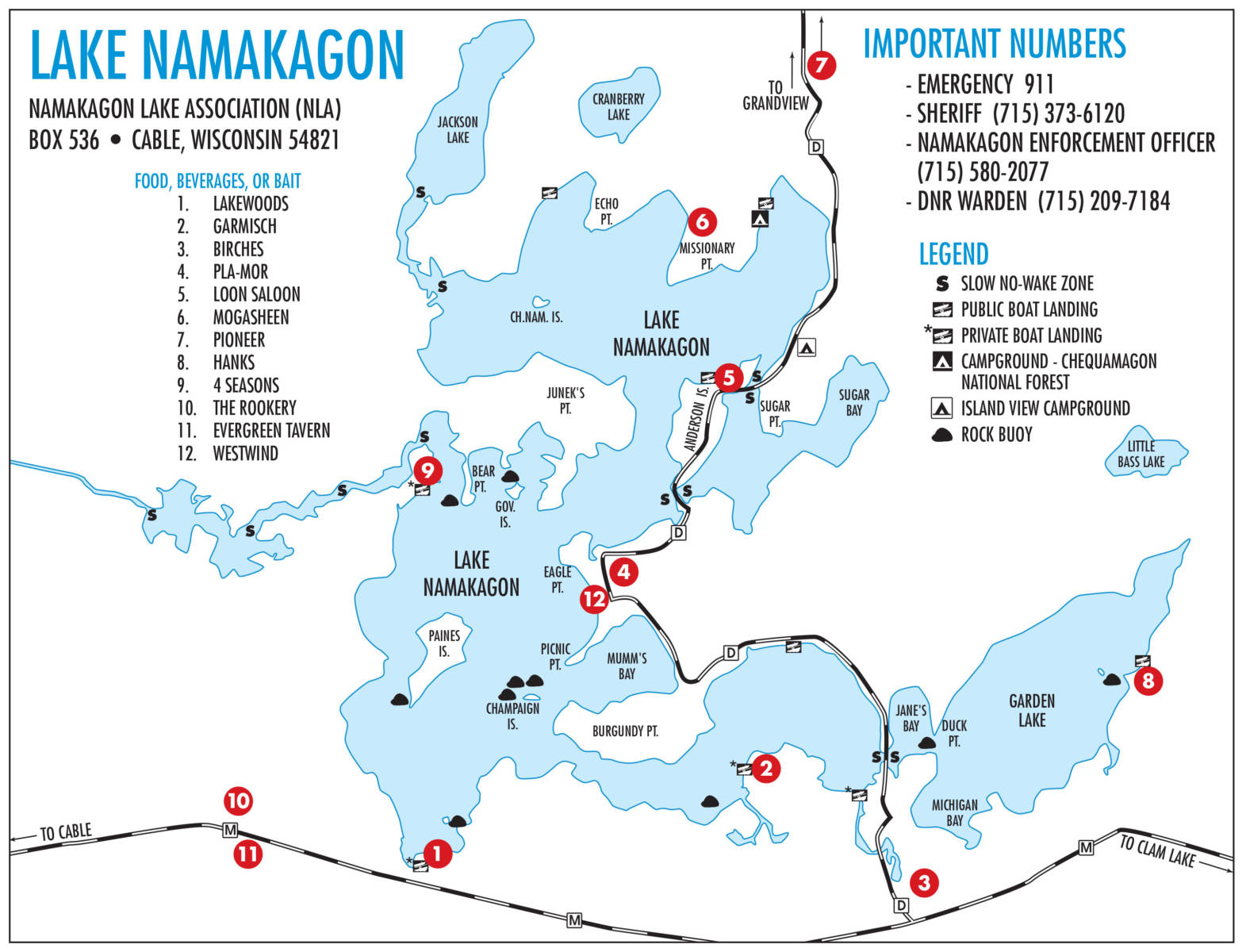
Lake Namakagon Information
About the Lake Namakagon area of Northern Wisconsin
Lake Namakagon (pronounced NAM-uh-KAH-gun) is a large freshwater lake located in the Chequamegon-Nicolet National Forest in Northern Wisconsin.
There is a dam owned by the Town of Namakagon on the west side of Lake Namakagon. Completed in 1926, the Namakagon Dam helps regulate water levels on the lake. With over 3,000 acres of water, there is plenty of room to explore by boat, kayak or canoe. Sailing and water skiing are also popular, and there are boat rentals and several public boat launches. Quiet boats can explore Lake Namakagon’s many bays and islands, including Paines Island where local pairs of eagles nest in the spring.
A Class A muskie lake, Lake Namakagon is one of only three lakes in Wisconsin managed as a trophy muskie lake. There are also healthy populations of walleye, northern pike, bluegill, crappie, and largemouth and smallmouth bass. In the winter there is ice fishing.
LAKE FACTS
Location: Bayfield County, Wisconsin near Cable, Wisconsin
Coordinates: 89°59′59″N 179°59′59″W Coordinates: 89°59′59″N 179°59′59″W
Lake type: Glacial lake
Average depth: 38 ft (13 yd)
Max. depth: 51 ft (17 yd)
Water volume: 52,032 acre feet (64,181,000 m3)
Shore length: 43.67 mi (70 km)
Islands: Paines Island, Anderson Island


